
↓
 

Andalusia Land Surveying

Local Land Surveyors in Andalusia, AL

Andalusia Land Surveying
(334) 697-8008
Andalusia Land Surveying
  • Home
  • ALTA Survey
  • Boundary Surveying
  • Construction Survey
  • Drone LiDAR Mapping
  • Elevation Certificate
  • Land Surveying
  • Topographic Survey
  • Blog
  • Contact Us
Home 1 2 3 … 7 8 >>

Post navigation

← Older posts

Welcome to Andalusia Land Surveying

Andalusia Land Surveying Posted on August 18, 2017 by AndalusiaSurveyorMarch 24, 2020

Your Final Stop for ALL of Your Survey Needs!                                         Contact us today for a free quote!

This site is intended to provide you with information on Land Surveying in the Andalusia, AL and Covington County area of Alabama. If you’re looking for a Andalusia Land Surveyor, you’ve come to the right place. If you’d rather talk to someone about your land surveying needs, please call our local number at (334) 697-8008 today. For more information, please continue to read.
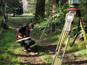
land surveyingLand Surveyors are professionals who alke precise measurements to determine the size and boundaries of a piece of real estate.  While this is a simplistic definition, boundary surveying is one of the most common types of surveying related to home and land owners. If you fall into the following categories, please click on the appropriate link for more information on that subject:

Andalusia Land Surveying services:

    1. I need to know where my property corners or property lines are. (Boundary Survey)
    2. I have a loan closing or re-finance coming up on my home in a subdivision. (Lot Survey)
    3. I need a alp of my property with contour lines to show elevation differences for my architect or engineer. (Topo Survey)
    4. I’ve just been told I’m in a flood zone or I’ve been told I need an elevation certificate in order to obtain flood insurance or prove I don’t need it. (Flood Survey)
    5. I’m purchasing a lot/house in a recorded subdivision. (Lot Survey – See Boundary Survey if you’re not in a subdivision.)
    6. I’m purchasing a larger tract of land, acreage, that hasn’t been subdivided in the past. (Boundary Survey)
Contact Andalusia Land Surveying services TODAY at (334) 697-8008.

Posted in boundary surveying, elevation certificate, land surveying, land surveyor | Tagged Andalusia Land Surveying, boundary survey, land surveyor, land surveyor al

How a Construction Survey Keeps Workforce Housing Projects Aligned With Roads and Utilities

Andalusia Land Surveying Posted on July 31, 2026 by AndalusiaSurveyorJuly 31, 2026
construction survey crew staking roads and utility corridors for workforce housing in Andalusia Alabama

A construction survey does the quiet work that keeps a workforce housing project from falling apart before the first family moves in. These developments pack roads, water lines, sewers, power and dozens of homes onto one site, usually on a tight schedule. When several crews show up at once, each one needs to know exactly where its work belongs. That is where accurate field measurement earns its keep. It ties every road, pipe and building pad to one shared framework, so the pieces actually meet the way the plans promised.

Building a Survey Control Network Before Multiple Crews Enter the Site

The first thing a surveyor sets up on the site is a control network, a set of permanent reference points with known horizontal positions and elevations. Road contractors, utility installers, grading crews and home builders all measure from these same points. Because everyone works off one system, nobody has to guess where the property line, the road or a pad should sit.

Without shared control, each crew tends to build its own version of the truth. The grading team might set an elevation the sewer crew never sees, and then the pipes end up too high to drain. A good control network prevents that split, since one coordinated framework holds the whole site to a single set of numbers.

Setting Street Centerlines and Curb Offsets Before Housing Pads Are Staked

Streets come before houses, and the survey follows that order. Surveyors stake the proposed street centerlines, intersections, curb lines and rights-of-way first, then lay out individual housing pads against those lines. This sequence matters because almost every measurement on a residential lot depends on where the street actually lands.

Once the road framework is set, setbacks fall into place, driveways connect at sensible angles and homes keep even spacing along the block. Fire trucks and moving vans need room to turn and pass, so accurate curb offsets protect that clearance too. When pads come before finished street lines, those relationships drift, and the later fixes cost real money.

Positioning Utility Corridors, Crossings, and Service Laterals

Underground infrastructure has to share space with roads and pads without clashing. Construction surveying guides where each system goes, so the pipes and conduits fit their corridors and cross one another only in planned spots. Surveyors typically position:

  • Water mains and their connection points to each unit
  • Sanitary sewer lines set at the depth and slope that keep waste flowing by gravity
  • Storm drainage that carries runoff away from homes and streets
  • Electrical corridors and other dry utilities
  • Service laterals running from the mains to individual houses

Easements set the legal limits for this work, so surveyors keep every line inside its corridor. They also mark planned crossings, where one utility passes over or under another, so trenching crews avoid nasty surprises. Because the pipes, streets and pads all reference the same control, the underground layout stays coordinated with everything happening above it.

Carrying Road Elevations Into Finished Floors and Driveway Grades

Elevation is where a lot of housing projects quietly succeed or fail. Surveyors take the approved road profile, the plan that sets how high the finished street will sit, and carry those heights outward to curbs, driveways, pads and finished-floor points. Every one of those spots connects back to the road elevation, so the numbers have to line up.

Driveways show the payoff first. A driveway that meets the street too steeply scrapes bumpers, while one that is too flat holds water after every storm. When the surveyor transfers the curb height correctly, the slope stays usable, and the entrance meets the street at the height the plans intended.

The same care protects drainage and sewer flow. Sanitary lines rely on gravity, so a pad set even a few inches wrong can slow or stop the flow to the main. Finished floors also need to sit high enough above the street and the surrounding grade to shed water during heavy rain. Getting these vertical relationships right keeps homes dry and utilities working long after the crews pack up.

Rechecking Critical Tie-In Points as Each Phase Advances

Layout is not a one-time event on a project this size. Before crews backfill utility trenches, pour curbs or pave roads, the surveyor goes back and checks the critical tie-in points. These checks confirm that a pipe, a curb or a pad still sits where the plan puts it, while the work is still easy to adjust.

Plans also change mid-project, and equipment or weather can knock layout stakes out of place. When the design changes, surveyors rerun the calculations and replace the disturbed points, so the field matches the current drawings. As each new group of homes begins, they verify that the fresh phase still connects cleanly to the streets and utilities already in the ground.

Frequently Asked Questions

When should construction surveying begin on a workforce housing project?

It should start before clearing, grading, road building or utility installation, because control and early layout guide all of that work. Setting the framework first keeps the earliest crews from making decisions the later ones cannot undo. After that, expect more staking and verification as each phase moves ahead.

Can road, utility, and building contractors use the same survey control points?

Yes, and they should. A coordinated control network gives every contractor the same horizontal and vertical reference, which is exactly what keeps their work compatible. Crews do need to use the approved points, though, and should never relocate or recreate markers on their own, since a homemade reference brings back the very conflicts the network exists to prevent.

What should happen when road grades or utility plans change after staking?

The revised plans should reach the surveyor before any affected work continues. From there, the surveyor updates the calculations, restakes the changed areas and verifies the results in the field. That process keeps housing pads, driveways, drainage features and utility connections lined up with the new design instead of the old one.

Posted in construction | Tagged construction survey

Commercial Development Along a Highway Can Uncover Access Rights Nobody Expected

Andalusia Land Surveying Posted on July 16, 2026 by AndalusiaSurveyorJuly 16, 2026
Aerial view of highway businesses linked by a shared driveway, service road, and turn lane along a commercial frontage.

Buying a commercial lot next to a busy highway feels straightforward until an ALTA survey opens the title file and shows what really controls the driveway. The way traffic gets on and off the property might depend on rights that were written down years ago and then forgotten. A shared entrance, a service drive across a neighbor or an old easement can decide whether a planned store even works on that corner. Pairing the recorded rights with a careful measurement of the site is the point of this kind of survey, and it often brings surprises to light before they turn expensive.

A plain boundary drawing shows where the land sits. This survey goes further by folding the title record into the picture, so a buyer sees ownership, easements and physical conditions on one sheet. For highway commercial deals, access is usually the piece that makes or breaks the plan.

Tracing Every Recorded Route to the Public Road

Every commercial site needs a legal way onto the public road, and that way is not always the driveway you can see. Title documents may hold access easements, shared entrances, service drives or limits placed on the property long ago. Each recorded route counts, whether or not anyone still drives it.

The surveyor reads the title commitment and plots each of these rights against the parcel. Some grant access the buyer never knew existed. Others restrict it in ways that change where a building or an entrance can go. Laying them all on the drawing turns a vague sense of how to reach the road into a set of firm lines a designer can trust.

Comparing Recorded Access With the Driveways Used Today

Paper and pavement often tell different stories. The way trucks and cars actually enter a site may not match the rights written in the title file. A driveway that has served the property for twenty years might cross land the owner holds no recorded right to use.

Spotting that gap early saves a buyer from a hard lesson. The survey shows the driveways in use and the access the documents grant, side by side. When the two fail to line up, the transaction team can chase down a missing easement or plan a new entrance before closing. Finding it afterward is far more painful, since the neighbor now holds the leverage.

Locating Road Widening, Turn-Lane, and Right-of-Way Interests

Highways grow, and that growth eats into the lots beside them. A transportation agency may hold rights for road widening, a turn lane or a future right-of-way that trims the usable frontage of a commercial parcel. Those interests can sit quietly in the record until a project brings them forward.

An ALTA survey locates them so a buyer knows the true developable area, not the shape on the tax map. Losing ten feet of frontage to a planned widening can shrink parking, block an entrance or push a building back past what the plan allowed. Learning about it before design starts lets the team work with the real edges rather than guessing.

Examining Shared Access Across Neighboring Businesses

Commercial corners often share their driveways. Cross-access agreements let neighboring businesses use one entrance or drive aisle, which spreads traffic and saves curb cuts. These arrangements can help a site, and they can also tie its hands.

The survey examines how access crosses between parcels and what each recorded agreement requires. A shared drive might carry duties to maintain pavement, keep a lane open or leave a neighbor room to turn. Those terms shape circulation, future building placement and even redevelopment plans. Reviewing them at the start tells a buyer how much freedom the site really offers.

Giving Buyers a Clearer Picture Before Site Design Begins

Before design begins, the survey usually helps the team settle questions such as:

●        Where a legal entrance can go and how wide it may be

●        How much frontage a future road project might take

●        Which neighbor agreements govern shared drives and parking

By bringing title rights and measured conditions onto one sheet, the survey gives buyers, lenders and designers a shared starting point. Everyone works from the same facts instead of separate assumptions. That common ground trims the guesswork and lowers the odds of a nasty surprise once construction money is on the line.

Frequently Asked Questions

Will an ALTA Survey show whether a commercial driveway is legally permitted across another parcel?

It shows the recorded access rights that touch the property and plots them against the driveways in use. If an easement grants the right to cross a neighbor, the survey reflects it. If no such right appears in the title record, the drawing makes that gap visible so the team can deal with it.

Can recorded highway right-of-way reduce the property area available for development?

Yes. A right-of-way, a planned widening or a turn-lane interest can take part of the frontage and shrink the area you can actually build on. The survey locates those interests, so the developable ground shown is the real figure rather than the full parcel on paper.

What title documents should be supplied before the survey begins?

The surveyor needs the title commitment along with copies of the listed exceptions, such as easements, agreements and prior deeds. Supplying these early lets the crew plot every recorded right against the site. Missing documents leave gaps the drawing cannot fill.

Posted in ALTA Survey | Tagged ALTA Survey

Property Owners Often Learn Too Late Where Stormwater Naturally Flows Across Their Land

Andalusia Land Surveying Posted on June 22, 2026 by AndalusiaSurveyorJune 21, 2026
Rainwater collecting in low areas of a residential yard, illustrating natural stormwater flow across a property

A land survey usually gets ordered for one reason: to confirm where the property lines sit. What it also reveals, almost as a side effect, is something many owners never think to ask about. Stormwater has been moving across that land in the same general pattern for years, long before anyone built a driveway or planted a row of trees. Most people never learn that pattern until a problem forces them to look.

By the time water shows up where it shouldn’t, the cost of fixing it has usually gone up. A fence redirected runoff toward a barn. A new driveway blocked a path water used to take through the yard. None of these decisions were made carelessly. They were made without knowing where the water was already going.

Natural Drainage Patterns Can Exist Even on Land That Appears Flat

A lot of land doesn’t look like it drains anywhere in particular. No hills, no obvious slope, nothing that screams water goes this way to someone standing in the middle of it. That impression is usually wrong. Even gentle, even-looking ground almost always has a direction it favors. Elevation changes too small to notice by eye shape in that direction.

These subtle slopes and shallow depressions matter more during a storm than they do on a normal day. A property can look perfectly dry for months. Then it shows its true drainage pattern the moment a heavy rain hits. Water finds the lowest available path and follows it, whether or not that path is visible during dry weather. The land has a memory of sorts. Years of small rain events, and a handful of big ones, have shaped it. That history doesn’t disappear just because the ground looks even.

This becomes a real issue once someone starts planning improvements. A property owner might assume their land is flat because it looks flat. They can end up placing a structure or making a change directly in the path water has used for years. The mistake usually doesn’t show up immediately. It shows up the first time conditions match whatever pattern shaped that drainage path in the first place.

Why Building Locations Should Consider Existing Water Movement

Choosing where to put a home, a barn, or a driveway often comes down to convenience. A flat-looking spot near the road. A clear area with good tree cover. These are reasonable starting points. But they leave out something that matters just as much. Where does the water on that property already want to go.

Working with existing water movement instead of against it tends to produce fewer problems down the road. A barn placed slightly out of a natural flow path stays dry through storms that would otherwise pool water against its foundation. A driveway routed around a shallow natural channel avoids a common kind of washout. That damage tends to show up a year or two after paving, once the channel reasserts itself under the new surface.

This kind of planning isn’t about avoiding development on land with any drainage feature at all. Most properties have natural flow paths somewhere, and plenty of structures get built near them successfully. The difference comes down to knowing where those paths are before committing to a location. Discovering them after the first serious storm is the harder, costlier way to find out.

Land Surveying Provides Valuable Information for Drainage Planning

Land surveying is the tool that turns guesswork about drainage into something property owners can plan around. A survey captures the real elevations across a parcel, not just the boundary lines most people associate with the process. Those elevation readings reveal terrain features that explain how water behaves on the property, even when nothing about the surface looks unusual.

A surveyor working a parcel records spot elevations across the land, picking up the subtle highs and lows that shape drainage. Put together, these measurements show which direction water tends to move. They reveal where it’s likely to concentrate, and which areas stay genuinely dry versus which ones only look that way during normal weather. This information turns a vague sense of the yard gets soggy sometimes into a specific, mapped explanation.

For anyone planning a build or a major landscaping project, this kind of accurate measurement removes a lot of the uncertainty. The same goes for anyone just trying to understand a property better before making decisions. Instead of relying on memory or a single rainy afternoon, owners get a clear picture based on actual elevation data.

Fences, Access Roads, and Landscaping Can Change the Way Water Moves

Improvements made without understanding existing drainage patterns can unintentionally redirect water. A solid fence built along a low point in the yard can act like a small dam, backing water up against a foundation it was never near before. A driveway graded without accounting for a natural low spot can push runoff toward a neighbor’s property instead of letting it follow its original path.

Landscaping changes carry the same risk on a smaller scale. Mulch beds, raised garden borders, and significant tree removal can all shift how water moves across a yard. Sometimes this only becomes obvious after a heavy rain reveals the new pattern. None of these changes are unusual or careless on their own. The issue is that they’re often made without anyone checking what the original drainage pattern looked like first.

A few common improvements tend to cause these unintended shifts most often:

  • Solid fences built across a yard’s natural low point or drainage path
  • Driveways or access roads graded without accounting for existing water flow
  • Significant landscaping changes near a property’s natural drainage corridor

Evaluating stormwater flow before making these kinds of changes gives owners the chance to adjust a fence line or driveway design early. That beats discovering a permanent problem every time it rains.

Understanding Stormwater Paths Can Support Long-Term Property Use

Knowing where water naturally travels pays off well beyond the moment of construction. Residential owners get fewer surprises with foundation moisture and yard flooding. Farmers benefit too, seeing which sections of a field stay productive and which ones struggle after rain, often for reasons tied to drainage rather than soil quality. Commercial property owners avoid costly retrofits to parking areas or entrances that were never designed with water flow in mind.

This understanding also supports decisions made years after a property is first developed. A homeowner planning an addition, a farmer considering a new outbuilding, and a developer evaluating a second phase all need the same basic knowledge. They need to know how water has historically moved across that specific piece of land. That information doesn’t expire. It stays useful for as long as the property is owned and improved.

In the long run, owners who understand their land’s drainage patterns tend to avoid the expensive surprises that catch everyone else off guard. They build with the water instead of fighting it after the fact.

Frequently Asked Questions

How does land surveying help property owners understand drainage? 

Land surveying provides elevation and terrain information that helps reveal how water naturally moves across a property.

Can stormwater flow change over time? 

Yes. Heavy rains, grading activities, vegetation changes, and new improvements can all influence how water moves across the land.

Why should drainage be considered before building? 

Understanding water movement helps property owners make better decisions about structure placement and future improvements.

Can fences and driveways affect stormwater flow? 

Yes. Some improvements can redirect runoff, making it important to understand existing drainage patterns before construction.

Who benefits from understanding natural drainage paths? 

Homeowners, land buyers, builders, farmers, developers, and commercial property owners can all benefit from knowing how stormwater travels across their land.

Posted in land surveying | Tagged Land Surveying

Post navigation

← Older posts
Get Quote Button
© Boxer Survey USA
Andalusia Land Surveying

Andalusia, Alabama
Phone: (334) 697-8008

Web Development and SEO by:
AuburnBusiness.com, LLC


Privacy Policy | Terms of Use

The owner of this website, Boxer Survey USA, provides coordination of professional land surveying and engineering services in all 50 states. The professional surveying and engineering services provided to you will be conducted by fully licensed professionals in your state.

Privacy Policy
↑