
Why Builders and Engineers Always Start With a Topographic Survey
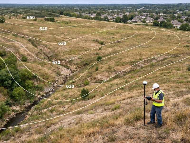
If you ask a builder or engineer what they do before starting any project, most will say the same thing: get a topographic survey. Before any digging begins, they need to know what the land looks like. Not just where the property lines are, but how the ground rises and falls, where water flows, and what is already sitting on the surface. A topographic survey gives them all of that. If you are building a home, developing land, or dealing with a drainage issue, this guide will explain what a topographic survey is and why it matters.
What Is a Topographic Survey?
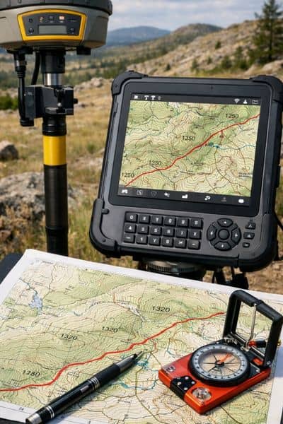
A topographic survey is a study of the physical features of a piece of land. It measures how high or low different parts of the ground are and records things like trees, buildings, and water. The final result is a map that shows the true shape of the land from one end to the other.
A topographic survey is not just about property lines. It shows the actual shape of the ground. This helps builders, engineers, and designers plan projects that fit the land properly.
A licensed surveyor uses GPS tools, measuring equipment, and sometimes drones to gather data points all across the property. That information is used to create a map that shows:
- Contour lines that reveal how the ground goes up and down
- Natural features like trees, ponds, hills, and ditches
- Structures like buildings, driveways, walls, and fences
- Utility lines such as water pipes, sewer lines, and power lines where they are visible or marked
Contour lines are the key part of the map. Each line connects spots on the ground that are all at the same height. When the lines are close together, the ground is steep. When the lines are farther apart, the ground is flatter. Builders and engineers read these lines to figure out how to work with the land, not against it.
How Is a Topographic Survey Different from a Boundary Survey?
A boundary survey shows where a property legally begins and ends. A topographic survey shows what the land inside those lines actually looks like. One answers “Where is my property line?” The other answers “What does the ground look like?” Many projects need both before work can start.
These two surveys do very different jobs. A boundary survey is used when buying or selling land, settling legal disputes, or building a fence. A topographic survey is used when someone needs to design or build something on the land. Knowing which one fits your situation can save you both time and money.
When Do You Need a Topographic Survey?
You need a topographic survey when you are planning to build, fix a drainage problem, develop land, or apply for a building permit. Any project where the shape of the ground plays a role in the design will likely require one. Most engineers and architects will ask for it before they begin any planning work.
Here are the most common times a topographic survey is needed.
Building a New Home
An architect needs to know how the land sits before drawing up a home design. A topographic survey shows where the ground slopes, how rain drains off the property, and where the best spot for the foundation is. Without this, a home could be built in the wrong place or in a way that causes water problems down the road.
Developing or Subdividing Land
When someone wants to split land into smaller lots or build a development, they need to know how the land lays out. A topographic survey helps plan where roads, utilities, and drainage systems will go. Getting this right early prevents costly mistakes once construction begins.
Fixing Drainage Problems
Some properties hold water after a heavy rain. Others have areas that stay wet for days. A topographic survey shows exactly how water moves across the land. With that information, an engineer can design a proper fix that actually solves the problem.
Large Landscaping Projects
If you are planning to add a retaining wall, a pond, or an outdoor living space, you need accurate information about the ground. A topographic survey tells the designer how the land drains and where the slopes are, so the finished project works the way it should.
Applying for Building Permits
Some local governments ask for a topographic survey before they approve a building permit. Having one ready when you apply can speed up the process and keep your project on track.
FEMA Flood Zone Reviews
Engineers use topographic data when reviewing whether a property has been placed in the right flood zone. If you think your property has been incorrectly listed as a flood risk, accurate elevation data from a topo survey is one of the main tools used to support a challenge with FEMA.
How Accurate Is a Topographic Survey?
The accuracy of a topographic survey depends on the tools used and the needs of the project. Most surveys for home construction use measurements every one to two feet in elevation. Projects that involve careful grading or drainage work may need measurements every half a foot.
Today’s tools have made surveys faster and more accurate. Drones, for example, can gather data up to ten times faster than older ground-based methods on large properties, according to the American Society for Photogrammetry and Remote Sensing. This means you get your results sooner without losing accuracy.
How Much Does a Topographic Survey Cost?
For most homes, a topographic survey costs between $500 and $2,500. The price depends on the size of the property, how difficult the land is to work on, and how much detail is needed. Larger or more complex properties will cost more. The best way to get a real number is to contact a licensed land surveyor and describe your project.
Here are the main things that affect the price:
- Property size: Bigger properties take more time and effort to survey.
- Terrain difficulty: Wooded or hilly land is harder to measure and takes longer.
- Level of detail needed: A survey for an engineering project needs more precision than one for general planning.
- Local rates: Prices can vary depending on where you live.
Who Should Do a Topographic Survey?
A topographic survey must be done by a licensed professional land surveyor. This is not a job for someone without proper credentials. Engineers, architects, and government offices will only accept data from a licensed surveyor. If the work is done by someone unlicensed, it will likely need to be done over again, costing you more time and money.
When looking for a surveyor, choose someone with a current state license, experience with your type of project, and a clear way of explaining what they will give you and when.