
Property Owners Often Learn Too Late Where Stormwater Naturally Flows Across Their Land
A land survey usually gets ordered for one reason: to confirm where the property lines sit. What it also reveals, almost as a side effect, is something many owners never think to ask about. Stormwater has been moving across that land in the same general pattern for years, long before anyone built a driveway or planted a row of trees. Most people never learn that pattern until a problem forces them to look.
By the time water shows up where it shouldn’t, the cost of fixing it has usually gone up. A fence redirected runoff toward a barn. A new driveway blocked a path water used to take through the yard. None of these decisions were made carelessly. They were made without knowing where the water was already going.
Natural Drainage Patterns Can Exist Even on Land That Appears Flat
A lot of land doesn’t look like it drains anywhere in particular. No hills, no obvious slope, nothing that screams water goes this way to someone standing in the middle of it. That impression is usually wrong. Even gentle, even-looking ground almost always has a direction it favors. Elevation changes too small to notice by eye shape in that direction.
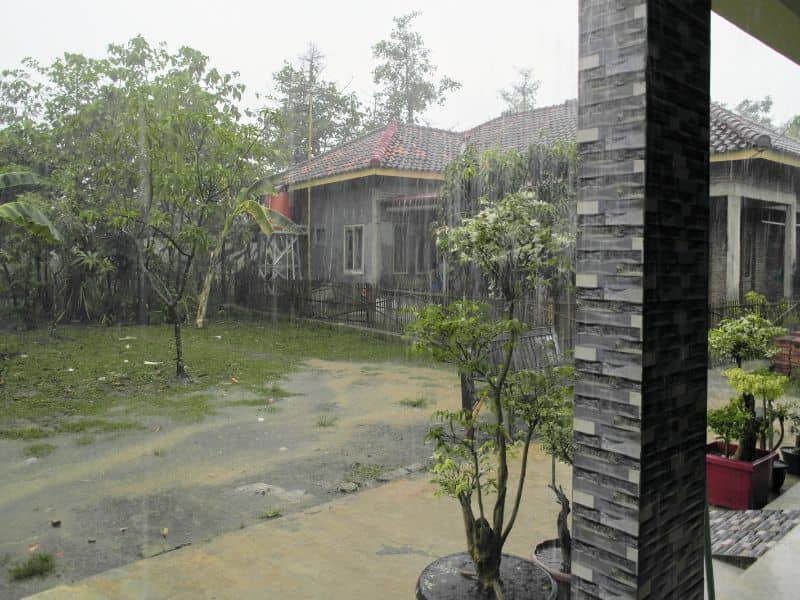
These subtle slopes and shallow depressions matter more during a storm than they do on a normal day. A property can look perfectly dry for months. Then it shows its true drainage pattern the moment a heavy rain hits. Water finds the lowest available path and follows it, whether or not that path is visible during dry weather. The land has a memory of sorts. Years of small rain events, and a handful of big ones, have shaped it. That history doesn’t disappear just because the ground looks even.
This becomes a real issue once someone starts planning improvements. A property owner might assume their land is flat because it looks flat. They can end up placing a structure or making a change directly in the path water has used for years. The mistake usually doesn’t show up immediately. It shows up the first time conditions match whatever pattern shaped that drainage path in the first place.
Why Building Locations Should Consider Existing Water Movement
Choosing where to put a home, a barn, or a driveway often comes down to convenience. A flat-looking spot near the road. A clear area with good tree cover. These are reasonable starting points. But they leave out something that matters just as much. Where does the water on that property already want to go.
Working with existing water movement instead of against it tends to produce fewer problems down the road. A barn placed slightly out of a natural flow path stays dry through storms that would otherwise pool water against its foundation. A driveway routed around a shallow natural channel avoids a common kind of washout. That damage tends to show up a year or two after paving, once the channel reasserts itself under the new surface.
This kind of planning isn’t about avoiding development on land with any drainage feature at all. Most properties have natural flow paths somewhere, and plenty of structures get built near them successfully. The difference comes down to knowing where those paths are before committing to a location. Discovering them after the first serious storm is the harder, costlier way to find out.
Land Surveying Provides Valuable Information for Drainage Planning
Land surveying is the tool that turns guesswork about drainage into something property owners can plan around. A survey captures the real elevations across a parcel, not just the boundary lines most people associate with the process. Those elevation readings reveal terrain features that explain how water behaves on the property, even when nothing about the surface looks unusual.
A surveyor working a parcel records spot elevations across the land, picking up the subtle highs and lows that shape drainage. Put together, these measurements show which direction water tends to move. They reveal where it’s likely to concentrate, and which areas stay genuinely dry versus which ones only look that way during normal weather. This information turns a vague sense of the yard gets soggy sometimes into a specific, mapped explanation.
For anyone planning a build or a major landscaping project, this kind of accurate measurement removes a lot of the uncertainty. The same goes for anyone just trying to understand a property better before making decisions. Instead of relying on memory or a single rainy afternoon, owners get a clear picture based on actual elevation data.
Fences, Access Roads, and Landscaping Can Change the Way Water Moves
Improvements made without understanding existing drainage patterns can unintentionally redirect water. A solid fence built along a low point in the yard can act like a small dam, backing water up against a foundation it was never near before. A driveway graded without accounting for a natural low spot can push runoff toward a neighbor’s property instead of letting it follow its original path.
Landscaping changes carry the same risk on a smaller scale. Mulch beds, raised garden borders, and significant tree removal can all shift how water moves across a yard. Sometimes this only becomes obvious after a heavy rain reveals the new pattern. None of these changes are unusual or careless on their own. The issue is that they’re often made without anyone checking what the original drainage pattern looked like first.
A few common improvements tend to cause these unintended shifts most often:
- Solid fences built across a yard’s natural low point or drainage path
- Driveways or access roads graded without accounting for existing water flow
- Significant landscaping changes near a property’s natural drainage corridor
Evaluating stormwater flow before making these kinds of changes gives owners the chance to adjust a fence line or driveway design early. That beats discovering a permanent problem every time it rains.
Understanding Stormwater Paths Can Support Long-Term Property Use
Knowing where water naturally travels pays off well beyond the moment of construction. Residential owners get fewer surprises with foundation moisture and yard flooding. Farmers benefit too, seeing which sections of a field stay productive and which ones struggle after rain, often for reasons tied to drainage rather than soil quality. Commercial property owners avoid costly retrofits to parking areas or entrances that were never designed with water flow in mind.
This understanding also supports decisions made years after a property is first developed. A homeowner planning an addition, a farmer considering a new outbuilding, and a developer evaluating a second phase all need the same basic knowledge. They need to know how water has historically moved across that specific piece of land. That information doesn’t expire. It stays useful for as long as the property is owned and improved.
In the long run, owners who understand their land’s drainage patterns tend to avoid the expensive surprises that catch everyone else off guard. They build with the water instead of fighting it after the fact.
Frequently Asked Questions
How does land surveying help property owners understand drainage?
Land surveying provides elevation and terrain information that helps reveal how water naturally moves across a property.
Can stormwater flow change over time?
Yes. Heavy rains, grading activities, vegetation changes, and new improvements can all influence how water moves across the land.
Why should drainage be considered before building?
Understanding water movement helps property owners make better decisions about structure placement and future improvements.
Can fences and driveways affect stormwater flow?
Yes. Some improvements can redirect runoff, making it important to understand existing drainage patterns before construction.
Who benefits from understanding natural drainage paths?
Homeowners, land buyers, builders, farmers, developers, and commercial property owners can all benefit from knowing how stormwater travels across their land.